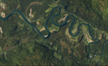
River Deep Mountain AI
Competition: Breakthrough 4: Transform
Amount awarded: £5,080,719
Led by: Northumbrian Water
Partners: ADAS, Anglian Water, Cognizant, Dŵr Cymru Welsh Water, Northern Ireland Water, South West Water, Stream, The Rivers Trust, Tidal, Google LLC., Uisce Éireann, Water Research Centre Limited, Wessex Water, Xylem Inc.
Estimated completion date: March 2026
Water cycle tag: Rivers, catchments, groundwater
We will develop open-source, scalable, digital models to inform effective action to tackle waterbody pollution. Our novel use of Machine Learning will efficiently analyse existing data and new diverse data inputs. This will unlock new insights into the complex factors impacting waterbodies, bringing deeper understanding and accelerating positive change.
“The River Deep Mountain AI (RDMAI) project is set to revolutionise the way we gather insights and data on waterbody pollution – and will accelerate real positive environmental change across our regions. We are really excited to launch this exciting project at our very own Innovation Festival in July.” – Nigel Watson, Group Information Services Director, Northumbrian Water Group
—
Update from the project (July 2025)
In June 2025, River Deep Mountain AI completed phase 2 of the project, focused on developing and initial testing of multiple AI/ML and remote sensing models addressing core challenges in the water sector. Throughout the phase, the project consortium has collated relevant datasets from across the sector, run experiments with AI/ML models, and completed several co-creation sessions with partners and stakeholders to ensure that models address the right challenges in the right way. The first major milestone of River Deep Mountain AI was reached in June, when the first batch of AI/ML and remote sensing models were released open source on GitHub. The first release covers key challenges such as river flow predictions, novel datasets of pollution sources, and mapping pollution hotspots. The models are released early to showcase our work to date and invite feedback from the entire water sector at a stage where changes are still possible. As River Deep Mountain AI enters phase 3 of the project, we will continue to improve the models, validate them in new catchments, and evaluate their ability to scale across the UK. In November 2025, the re-fined versions of the models will be released to the wider sector.